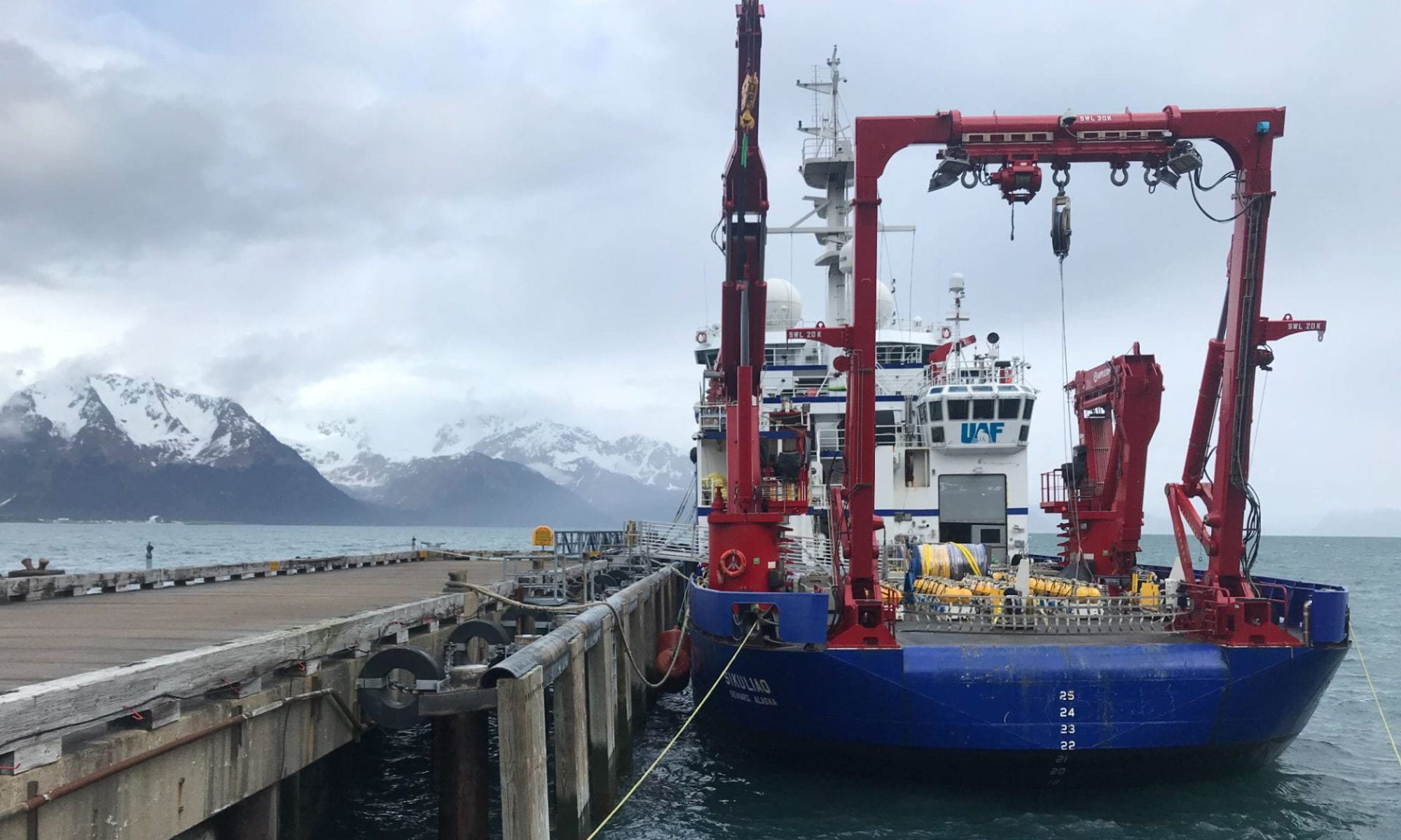
This is a long overdue post, it has been nearly a month since we concluded the first EPIC journey. EPIC part 1 was an epic success. We achieved all of our goals for the survey. We deployed 70 OBEM and recovered 43 of them, leaving behind 27 stations to record for the next 12 months. We also deployed 27 co-located OBS, which will record earthquakes for the next 12 months.
In addition to seafloor geophysical instrument operations, we collected a significant quantity of high-resolution multibeam bathymetry data over unmapped seafloor, discovering multiple new seamounts in the process. During the cruise, Jim, Ryan, and myself (the co-chief scientists) gave numerous lectures to our student volunteers on many aspects of marine seismic and magnetotelluric (MT) methods, along with training on MT and multibeam bathymetry data processing.
Next year, we will again head to sea to collect the remaining seafloor instruments and do some seafloor dredging to sample some of the seamounts we have discovered. Stay tuned for future blog posts about initial data products and science results from this deployment cruise, not to mention the EPIC recovery cruise!
Today’s blog post is by guest author Raquel Barrientos, written in Spanish below. But first, a quick announcement. Natalia Montoya celebrated her birthday offshore on November 1st. Natalia is a geology student at Universidad de Costa Rica. She is currently working on her thesis using a variety of geophysical tools to map subsurface caverns. Happy birthday Natalia!
¡Hola! Esta entrada es para los que nos leen en español 🙂
Como quizás leyeron anteriormente, los voluntarios de este proyecto, nos hemos convertido en expertos (léase con entusiasmo y no tan textual) en el ensamjable de estaciones OBEM y excelentes nociones del armado de equipo OBS, gracias a las tres semanas que llevamos de trabajo. Este ha constado, principalmente, en preparar las estaciones previo a su despliegue, ensamblando cuatro electrodos, que miden el campo eléctrico, y dos magnetómetros de inducción, que se colocan perpendiculares entre sí para medir las variaciones del campo magnético. Otras tareas son desarmar, limpiar, testear y guardar el equipo.
Ocean-bottom electromagnetic receiver components. Componentes del receptor electromagnético de fondo oceánico.
El diaro se ve diferente para todos, pues el hecho de que las operaciones en el barco sean 24/7, vuelven ambiguos los horarios y mezclan en la cocina a quienes van de entrada y de salida. De cualquier modo, solemos tener lecciones magistrales a las 10:30 am (hora local) por parte Samer, Ryan o Jim, quienes nos instruyen en temas como los principios teóricos de los equipos que armamos, de la información que estos registran y su respectivo procesamiento e interpretación. Estas sesiones son posibles cuando los tiempos de tránsito entre un despliegue y otro son altos, algo como más de 2 horas. Aquí en el barco le llaman “downtime” y podría decirse que todos saben sacarle provecho.
A eso de las 11:30 am solemos ir directo a almorzar y, dicho sea de paso, hemos comido bien. Para quienes no les toca retomar su turno, les espera una buena siesta, o bien, el escritorio, la silla y la compu para sacar nuestro lado laborioso. Creo que todos los voluntarios compartimos cuarto con alguien más. En mi caso, somos tres en una misma habitación y solemos hacer las mismas cosas en momentos diferentes, como por ejemplo lavar u ordenar ropa, tener tiempo de ocio, continuar con pendientes universitarios, entre otros.
Algo más en lo que coincidimos la mayoría, es que el vaivén del barco nos provoca toda clase de sueños raros. En nuestro downtime durante el turno de la noche, cuando no estamos comparando quién tuvo el sueño más extraño, salimos a la cubierta a ver las estrellas; hemos tenido suerte viendo cielos despejados, estrellas fugaces y espectáculos de relámpagos.
Este trabajo, además de haber sido un desafío físico, ha sido uno intelectual, pues más allá de hacerme notar las cosas que aún no entiendo, también me ha hecho conocer las posibilidades que tienen la geofísica y la sismología, en colaboración, en la contrucción de modelos detallados del manto superior y que además, un mismo juego de datos recabados en este tipo de expediciones u otras cuyos resultados son de acceso libre en línea, dan para contestar una infinidad de preguntas según la perpectiva de quien los esté analizando y procesando.
All is well on the EPIC front. So, in the interim, I decided to offer this not-so-brief tangent on one of my biggest obsessions, the seafloor. Did you know that only a quarter of the ocean floor is mapped in high resolution? I was flabbergasted the first time I learned that we have better maps of the Martian surface than we do our own seabed here on Earth. All that pesky ocean water, essential for life, is opaque to light, shrouding the seafloor. This makes it impossible to image the shape of the seabed the way we do land. This is also why we have better maps of Mars, a dry planet with no water to mask our view of its rocky surface.
The fact that we have a relatively poor understanding of the seafloor morphology is crazier still considering that humanity has sent satellites to another planetary body 360 million kilometers away (Mars) and beamed back high-resolution images of its topography, let alone landed several rovers on its surface! This testifies to the challenging nature of the seafloor mapping problem (learn more about efforts to map the seabed by 2030 here).
Unlike light, sound travels efficiently through water. In fact, we can measure the seafloor depth by generating a pulse of sound using an underwater speaker (called an echosounder) attached to the hull of a ship. First we record the time it takes for the sound pulse to bounce off the seafloor and return to the ship. Then, since we know the speed of sound in water, it is straightforward to convert the two-way travel time of the sound pulse into seafloor depth.
Echosounders were developed in the 1920s and 30s. Visionary geoscientists, namely Marie Tharp and Harry Hess (among others), leveraged the sudden surge in seafloor profiling during World War II to create the first large-scale bathymetric maps of the Atlantic and Pacific Oceans. This ultimately led to the discovery of seafloor spreading and the plate tectonics revolution of the 1960s.
These days, we use much fancier tools, multibeam echosounders, to create swath bathymetry maps rather than linear profiles from a single echosounder (learn more about this and other seafloor mapping technologies here on Wikipedia). Yet there is still plenty of seafloor that remains to be mapped in high-resolution.
Which (finally…) brings me to the point of this post. We are proudly contributing to the Seabed 2030 mapping effort during our EPIC survey, using the multibeam system equipped on the R/V Langseth. The Google Earth images below show the extent of our mapping achieved so far, with the bottom image zooming in on a region riddled with seamounts. Seamounts are basically extinct volcanoes!
Indeed, we have even discovered multiple unmapped seamounts during our expedition, which we are now entitled to dedicate ceremonially with a name of our choosing (I am considering naming one after my cat, Soba Buckwheat Noodles. I know, best cat name ever). There is thought to be over 100,000 seamounts globally, but only a fraction have been mapped. That’s a lot of extinct volcanoes…
A 3D perspective view of a newly mapped pair of seamounts. My cat Soba is pictured inspecting his potential new throne. He’s a fierce long-haired domestic cat, with fuzzy paws and an extra fluffy tail, who constantly demands cuddles.
I could go on and on (and on) about how mesmerizing and awesome the seafloor is. I encourage all of you to stare at its beauty on Google Earth. Or check out GeoMapApp, a free software.
Today is a very special day. Quincey Nielson, the youngest member of our science party, is officially one year older. Quincey recently graduated with a bachelor’s degree in Solid Earth & Planetary Sciences from Georgia Tech. We celebrated with delicious cherry chocolate cake. Happy birthday Quincey!
Quincey celebrates in style, with cherry chocolate cake, yummmmmm. Fun fact, turns out Quincey, Natalia and I are all huge F1 fans.
In addition to birthday festivities, Luis Salas, our classical guitarist and designated cruise hero, is the guest blogger for the day. Below is his entry, in Spanish.
Han pasado 15 días desde que partimos de Puntarenas. Durante este tiempo he tenido la oportunidad de conocer personas de muchos lugares, y de distintas profesiones. También, aprendí como armar, y desplegar electromagnetómetros de fondo marino (OBEM por sus siglas en inglés), así como recuperarlos y desarmarlos.
Aunque cueste adaptarse al turno de la noche, he de decir que lo vale completamente, especialmente cuando el cielo está despejado y se pueden ver las estrellas, y los increíbles amaneceres.
Otra cosa que me ha gustado mucho son las lecciones—aunque a veces me duermo, porque son al final de mi turno—en estas, nos enseñan sobre el funcionamiento general del equipo con el que trabajamos, como es que reciben la energía y luego como se puede convertir en modelos que posteriormente serán interpretados. En general ha sido una experiencia ÉPICa donde he hecho amigos, he aprendido y he comido rico 🤣
Luis serenading the midnight-noon shift with some Costa Rican standards.
It is now Day 13 of 27, the halfway point on our EPIC voyage. Phase 1 of the project is complete. We spent the last few days successfully recovering all 22 OBEM from the first batch of deployments. The video below shows off an ideal recovery, sped up by 4x. Kudos to Amílcar for a perfect toss of the grappling hook.
The noon-to-midnight shift demonstrates a perfect OBEM recovery. Amílcar shows off his arm, throwing the grappling hook with pinpoint accuracy. After Jake pulls in the GPS buoy and streamline, Hayden easily connect with the crane hook, latching on to the receiver frame. This smooth recovery is made possible by the ship’s mates, the precision of their approach is unmatched time and time again, ensuring perfect recoveries.
With data in hand, I needed a sneak peek of the data quality. So I stayed up an extra few hours last night and did some quick-and-dirty processing to alleviate my anxiety. I am happy to report that most of the time-series have good signal-to-noise ratios and yield high-quality magnetotelluric (MT) transfer functions! Below is a spectrogram showing the MT signal in the time-series. Notice the slightly warmer colors on Oct 18 & 19; this is energy from the geomagnetic storm I mentioned in my previous post!
Spectrogram of electromagnetic time-series data from site MT1-18. Notice the higher amplitudes associated with the geomagnetic storm on Oct 18 & 19.
Just after midnight this morning, we kicked off Phase 2 and resumed deployments. It is now 10 am and we already deployed six more OBEM and one OBS. All this and we are one day ahead of schedule! We have also been quite lucky with smooth seas for the past week (*knocking on wood*). I am extremely grateful to the science party, techs, and crew for all their hard work. At this stage, the science party is a well-oiled machine, all team members certified experts at their craft.
To keep things interesting for the students during long transits in between deployments and recoveries, we have held multiple presentations and training sessions on seismic imaging, MT imaging, and multibeam swath bathymetry mapping. In fact, by the end of this survey, the students will have put their new knowledge to work, processing the multibeam bathymetry data from this cruise as well as reprocessing MT data from a prior project (SERPENT) that inspired EPIC.
Co-chief scientist Jim Gaherty shows the students how to process multibeam swath bathymetry data. We have already discovered multiple seamounts during this cruise, more on that in a future post!Co-chief scientist Ryan Porter teaches us all about seismic imaging of sharp boundaries using Receiver Functions. This type of analysis will be applied to the EPIC OBS data.
It’s been a productive week of ship time. Early this morning, we completed our first batch of deployments, a total of 11 OBS and 33 OBEM stations! One of our deployments was even graced with a rainbow. We will now begin recovering 22 of the OBEM. The remaining 11 OBEM are co-located with OBS and will remain on the seafloor. Those will be recovered during a second cruise at the end of next year, giving the OBS enough time to record a bunch of earthquakes. The longer recording time on the OBEM will provide sensitivity to the deeper reaches of the upper mantle and possibly even sensitivity to the mantle transition zone.
We were also blessed with a moderate geomagnetic storm yesterday, G2 on the NOAA scale (link to NOAA space weather page), providing a signal boost that should help ensure good data quality on the OBEM. Significant space weather is not required for acquiring high-quality data, but it provides some insurance and peace of mind, since some station locations have higher oceanographic noise sources. Having a higher signal is useful in such environments.
In other news, there was some unexpected excitement yesterday. As we were steaming to our next station, we received a distress call from a nearby fishing vessel. The crew of that vessel only spoke Spanish, so we called up our resident translator extraordinaire and University of Costa Rica geology student, Luis Salas (pictured), to come to the rescue.
Considering that we were operating in a remote part of the Pacific Ocean with no other ships in the water nearby, it behooved us to respond to the call, which is not only a courtesy to our fellow sailors but also mandated by maritime law. Thanks to Luis, the R/V Langseth captain, and the assistance of an onshore doctor on call, we were able to provide life-saving medication to the captain of the fishing vessel. The brief incident lasted only a few hours, but such experiences are few and far between, providing a jolt of excitement to us onlookers.
A Costa Rican flagged fishing vessel, in need of assistance while out on the open seas. Thankfully we were able to provide them with medication to treat their captain.
Meet our two fantastic deployment teams! The day team operates from noon to midnight, while the night team operates from midnight to noon. The day team members are:
Jake Perez (OBEM technician, Scripps Institution of Oceanography)
Alan Gardner (OBS technician, Woods Hole Oceanographic Institution)
Nahomy Campos (student, Universidad Nacional de Costa Rica)
Abhinav Singh (student, Georgia Institute of Technology)
Raquel Barrientos (student, Universidad de Costa Rica)
Luis Salas (student, Universidad de Costa Rica)
Quincey Nielson (student, recent graduate of Georgia Institute of Technology)
Ryan Porter (co-chief scientist, Northern Arizona University)
We have had a productive last 24 hours, having now deployed 13 OBEM and 2 OBS stations! Things started off slower than expected, as it took us nearly 60 hours to transit from Puntarenas to our first station. The ship had to push through a significant surface current, which slowed us down to a speed of 8 knots for about a day, when we were expecting 9.5–10 knots (one knot is equivalent to 1.852 kph, or 1.15 mph). During the transit, I gave a presentation on recent scientific results that motivated this project (more on the science goals in a future post), while Jake and Chris presented on the OBEM instrument components and safety protocols.
Since we operate around the clock (24 hours a day, seven days a week!), our science party started adjusting their sleep/meal cycles to prepare for their 12 hour shifts, which can be tiring work. We all took it easy on the first day while getting our sea legs, doing our best to avoid sea sickness (this is the first time at sea for all the students in the science party). On the second day, Chris and Jake gave us a walkthrough on OBEM instrument setup for deployments. This doubled as training for OBS deployments, since they share some design elements and procedures.
At 1 am on October 14, the night crew successfully deployed the first OBEM instrument of the project. The video below shows what a typical deployment looks like, but what’s not shown is the process of putting together an instrument, which is the majority of the work.
Thanks to the hard work of our techs and students, we are already making up some of the lost time from the slow transit.
Welcome to the first blog post of the epic East Pacific Imaging Cruise (EPIC). Our science party consists of three scientists, four technicians, and ten students. Yesterday we left port from Puntarenas, Costa Rica aboard the Research Vessel (R/V) Marcus G. Langseth to carry out our research project, funded by the National Science Foundation (NSF). We are currently on our way to deploy the first of 70 planned seafloor stations, spanning a large portion of the Cocos oceanic plate. The map below shows all the station locations. The yellow circles are stations where we will deploy both ocean-bottom seismometers (OBS) and ocean-bottom electromagnetic (OBEM) receivers. The white circles are stations where we will deploy only OBEMs. The data from these stations will be used to image the crust and mantle beneath the region. Stay tuned for more details in future blog posts!